 bNomadic
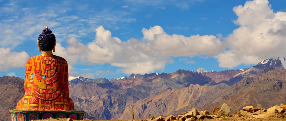
Book Talk: Life in Spiti

I am always thrilled to come home to lovely surprises. And this is precisely what had happened last week after I returned home from a nearly fortnight-long work-related travels – a pile of travel books that are patiently waiting to be read. And so, for the next few weeks, just like my previous post, I’ll be sharing my views on some of these books. The next one of the lot is an impressive coffee table book Life in Spiti by the noted Himalayan photographer Himanshu Khagta.
I have been a keen follower of Khagta’s works ever since he started to post his photo stories online. Life in Spiti is one of his photo projects to compile which he spent close to six months in the harsh environs of Spiti during the winters of 2014. Through this project, Khagta is trying to not only capture the beauty of the terrain or its people but the rigours of daily life of locals in winters when the temperature reaches minus 30 or even 40 degree Celsius. Isolated by arduous high mountain passes on both sides of the Spiti River, the trans-Himalayan valley gets virtually cut off from the rest of the world during winters after extreme snowfall. With very limited healthcare facilities and connectivity in the entire valley, winters prove to be a real test for locals as well as administration. Electricity is a sheer luck. Khagta recalls spending as much as 45 days without electricity in one go during the period he stayed there to collate the data for his project.

Forget spending an entire winter season in total absence of even typical village-like material comforts, though it may seem strange, a week in prime travel season here is dreaded by most compelled visitors. The valley is stretched on the northern side of the Great Himalayan Range on the north-eastern fringe of Himachal Pradesh. Through road, Spiti’s administrative headquarter Kaza can be accessed after a couple of days of drive from the state’s capital Shimla. Surrounded by treacherous terrains of Kullu, Lahaul, Ladakh, Kinnaur and Tibet, the valley nowadays is increasingly visited by adventure-seekers but mostly during summers. Quite naturally, much has been shared, published or photo-recorded from Spiti during this prime travel and adventure season. Khagta’s project has to be the first real visual lead insofar as documenting winter life of Spiti is concerned.
The book Life in Spiti comprises not all but 152 tastefully selected beautiful photographs from the time he spent in Spiti to compile the data and make photographs for his project. The valley’s social and religious fabric gets shaped from the imposing Buddhist monasteries that become alive with the participation of locals during the long winter season every year. With nothing else to do, winters are also the best time for the locals to renew their social ties and partake in the religious ceremonies. Khagta has patiently captured many such moments; the highlight being the records from a traditionally held marriage ceremony. The white Spiti, blue skies, barren but snowy mountains, light pollution-free night skies, ornamented outfits, monastic robes and winter chores, etc. are my hints from the content of this book.
Like in most modern coffee table photo books, the captions to the photographs in Life in Spiti are listed at the end of the book. This might irk an engaged reader but an informed photo enthusiast is thoroughly going to enjoy the style. The hardbound book will not occupy any extra space than a typical book. As for the variety in the photographs, I’d have wanted him to include a few more landscapes, especially highlighting the different moods of important peaks and passes of the region. The photos are centred on Kaza and its north upper portions and the Pin Valley, Losar, Dhankar and Tabo regions are not part of this book. May be we get to see those in the next book from this project.
I totally recommend this book to a mountain and Himalayan lover or a landscape and street photographer.
Finer Info
Publisher: Self-published
Total Pages: ~ 160
Price: Rs 2,999
Where to Buy: Life in Spiti or Amazon.in
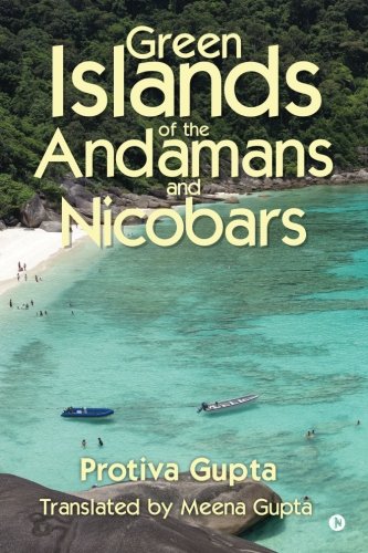
Book Talk: Green Islands of the Andamans and Nicobars

Ever since I sojourned on the wondrous and fascinating Andaman and Nicobar group of islands early this season, I have been wanting to know more about the history and geography of these tiny bits of lush green landmasses that are enclosed by ink black seas. Despite a plethora of travel guides and books available in the market, frankly speaking, there aren’t any good books on the Andamans and Nicobars that would qualify to be a piece of travel writing. I came across this book in a popular bookstore at Hyderabad on my most recent visit.
I must say that this is by far one of the best travel literatures on the Andamans and Nicobars available in a print format. Sharing anecdotes and stories from the times when the civilisation on this group of islands was still infant, Protiva Gupta’s book proves to be a rich storehouse of information. Through her book, Protiva not only recaps the history of this unique archipelago but captivatingly tells its many mysteries, folklore as well as the murmurs of the island life in the 1960s. With the highlight of the book being the researched narration of penal life in the Andamans, her travels to the Nicobars also deserves a mention.
The author, Protiva was born in 1918 and spent her childhood in Shimla and Delhi. It was after her marriage in 1942 to a civil engineer, who was then working with the Government of India, that she got multiple opportunities to travel across India including the Andaman and Nicobar Islands where the couple lived for four years (1961 to 1964). At the time she lived in the cluster of these tiny islands, Protiva was not only captivated by their stunning beauty but its recent history as well. During those days not much was known to the outer world about the Andamans and Nicobars except for its geography, an archipelago lying south east of the Indian mainland, in the Bay of Bengal. Ship used to be the only practical means of reaching the islands in those days. Ferrying passengers or transporting loads happened once a month and took nearly five days in touching Port Blair from Calcutta or Madras.
To me, the most attention grabbing part of the book is the description and stories of the aborigines, arrival of the British and the connection of the islands with India’s freedom struggle. Her narration underscores the times when the civilisation started to gain a foothold at these islands and the manner in which settlements were established by refuge seekers from East Pakistan. The times she spent in these islands are also tantamount to the period that is responsible for bringing many critical changes as well as development in the islands after India gained independence.
This fascinating travel book is not only based on a detailed research which she undertook to write it but is also a result of her extensive travels within the archipelago. Her excursion to Nicobars is particularly interesting. The book Green Islands of the Andamans and Nicobars was originally written in Bengali language as a series of stories and published in a vernacular magazine under two separate heads: the Andamans and the Nicobars. Protiva later compiled the stories into two books which were published in late 1960s. First published in 2013, this edition of the book is an English translation of the two Bengali books compiled into one. The translation of this book is expressively done by Meena Gupta, daughter of the author.

Today, the Andamans and Nicobars as described in her book may have changed beyond recognition but the exquisiteness of the landscape – a beautiful combination of sea, hills and forests – remains. Now with improvement in communication and transportation, habitation in the islands has increased manifolds. The once hostile native tribes have also been befriended. Unfortunately, in the process, much of the wild and untamed beauty has been lost. With the ever increasing avenues of tourism, the islands today attract a very large number of visitors. Despite the destructive tsunami of 2004, the Andamans continue to gain popularity among tourists.
The book should be of particular interest to a person who has visited these islands and wants to know more. The only thing I regret about this book is the lack of photographs, in fact, there is none. I’d totally recommend this book to anyone who feels mesmerized by the Andaman and Nicobar Islands. In about 250 pages, the author would intensify your desire to visit these islands again; this time with an informed perspective. The book is available at Rs 299 on amazon.in.
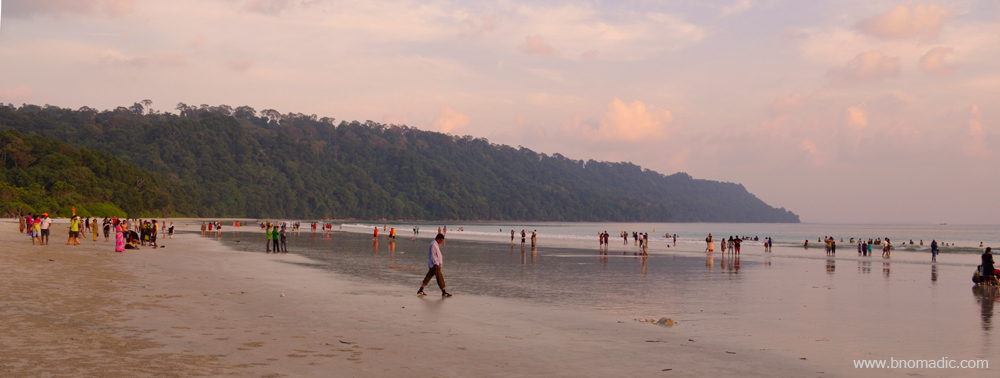
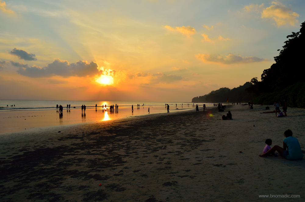
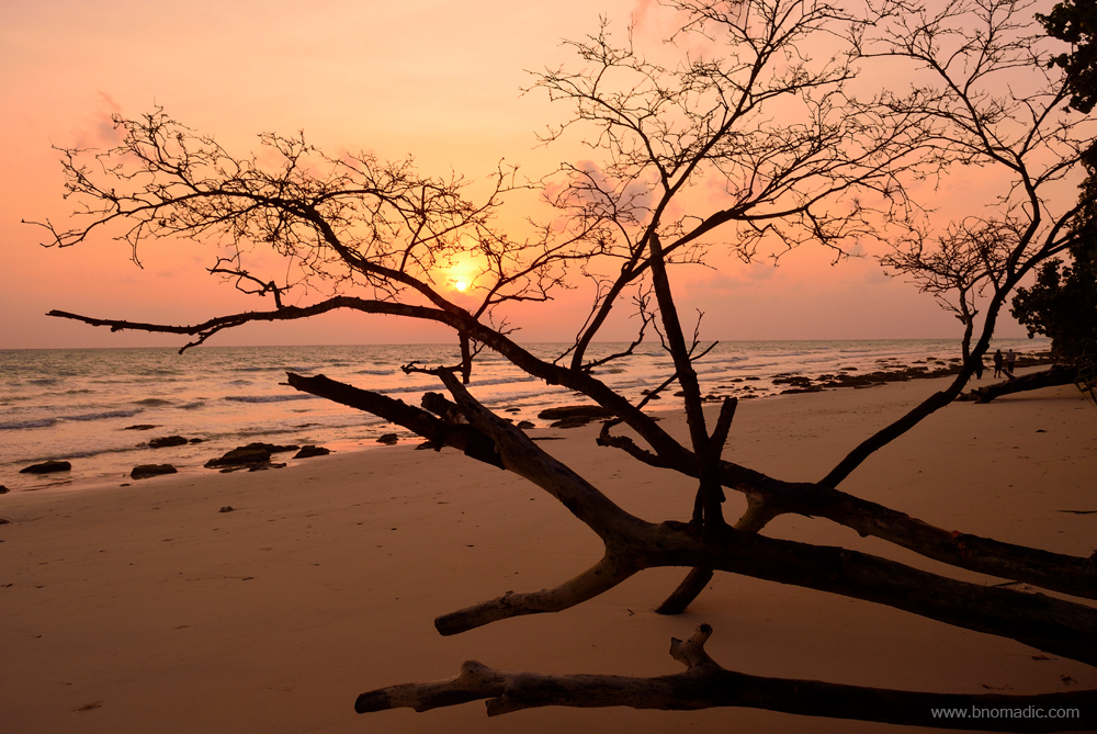
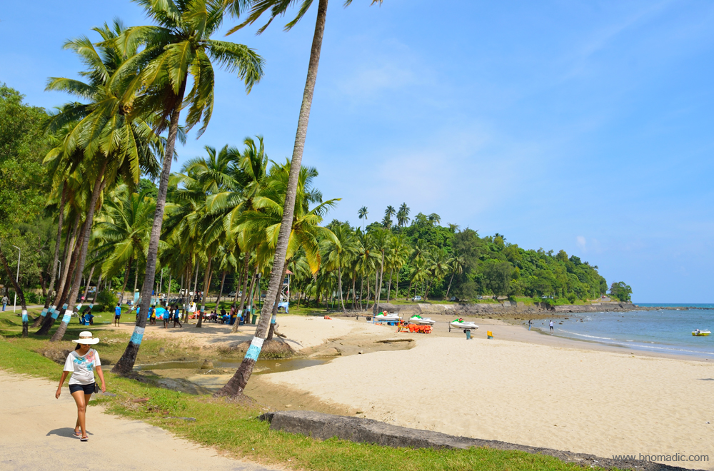
Andamans Diary: The white sandy beaches of Havelock Island
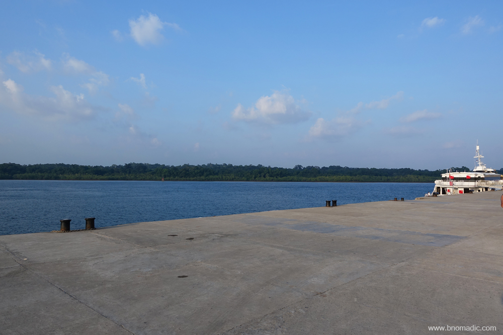
The brief spell of rains this morning had drenched the roads, settlement, port and jetties of Port Blair. Surrounding the jetty, the buildings look freshly painted and the trees have adorned a rich green colour. I reach the Phoenix Bay jetty a couple of hours before the scheduled departure of my ferry to the Havelock Island, the second most visited place in the Andamans after Port Blair. As if boarding an aircraft, the jetty operations of such inter-island ferries are professionally managed that involve fine bit of security clearance. My ferry, a privately owned small cruise, is scheduled at 1255hrs sharp and the boarding, they say, will commence just a few minutes before that.

Passengers inside the hall waiting for their ferry to arrive at the jetty. More images at Flickr

And the Makruz – a privately managed catamaran cruise service – ferry arrives. More at Flickr

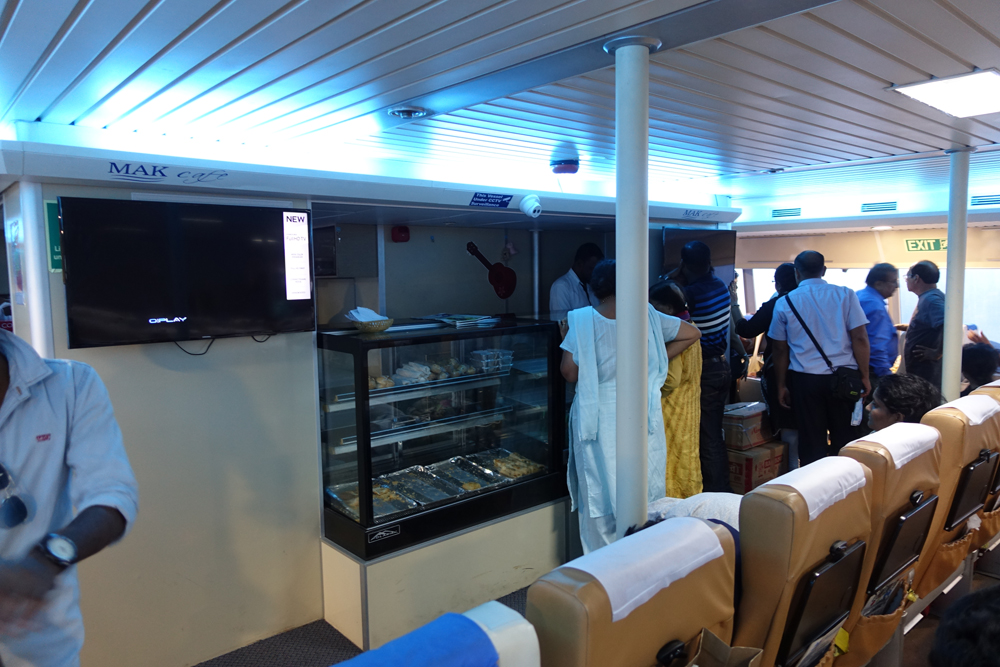
Most passengers comprises either first time holiday makers or honeymooners. More images at Flickr
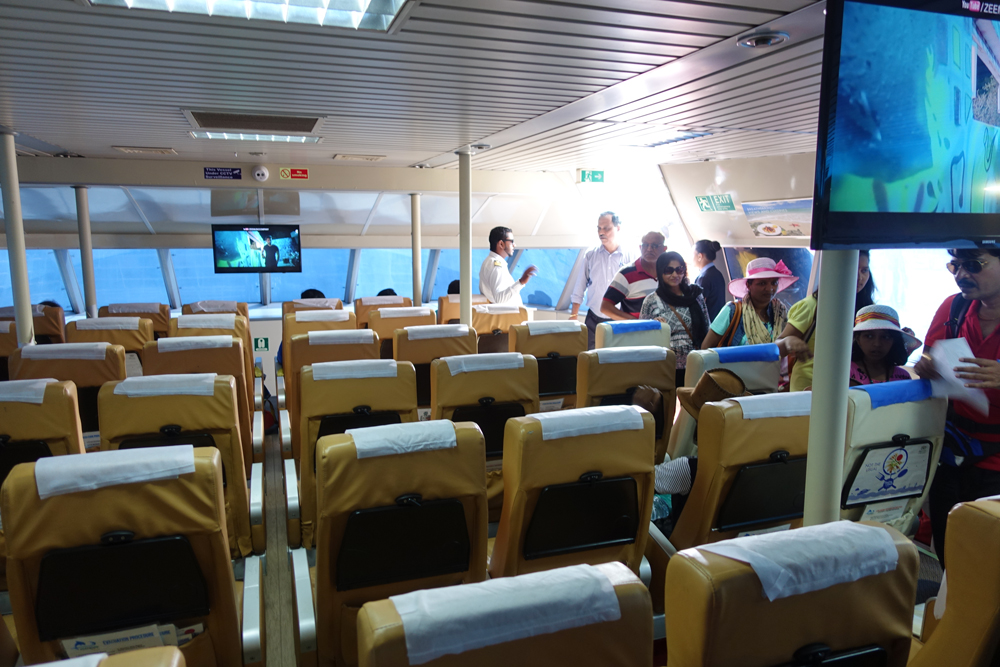
The sitting arrangement inside the ferry. Please visit Flickr for more images of the region
As the ferry arrives, the stewards quickly ushers us to our respective seats. The ferry, a catamaran has comfortable seats with a nearly soundproof compartment. Flat screens that play Bollywood songs dot the interiors. Soon, the boat leaves the jetty. The spectacular seascape is visible through large tinted glass windows but the travellers are prohibited from stepping on the deck outside the air-conditioned compartment. From the waters, the Andamans appear lush green. With every inch of soil studded with trees and shrubbery, the islands protrude like young hills above the blue water. Small untouched beaches interspersed with mangroves outline the greenery. The boat is floating gently out of the harbour into the deep sea, passing a few small boats. There are layers of colour on the land, deep green becoming grey and blue as they recede into the distance under a cloudy sky.
The passengers welcome the first heavy pitch of the boat with jubilation. A few minutes later, most have succumbed to sea sickness. The stewards immediately begin to distribute sickness bags. The jubilation is soon lost and nearly everyone – first time sea passengers and honeymooners – are praying for their dear life. As our vessel moves past the last sight of greenery, the pitching increases and couples with rolling. The announcements through the PA system try to keep the passengers engaged. With complete obliviousness, the crew announces that the sea is rough today and that it’s a norm. But then, most of us are witnessing the spectacle of a raging sea for the first time. With the horizon going topsy-turvy due to turbulence, our vessel is flinging in a deep sea. It climbs every roll of water landing with a huge splash.
Waves are crashing on the deck outside and onto the glass panes even as the stewards are trying their best to maintain calm inside the compartment. The sea’s fury tosses us around for nearly three hours before it finally reaches the Havelock jetty. Our catamaran, Makruz has negotiated fair bit of enormous crests and troughs to reach this island, I assume. Many passengers, mostly couples, are being helped out of the vessel at the jetty. We are in a state of both exhaustion and exhilaration after reaching Havelock. Having made landfall, almost all worries vanish for the time being. However, the very thought of having to return to Port Blair through the same route after sojourning here brings jitters.

Finally at the Havelock Jetty. Please visit Flickr for more images of the region
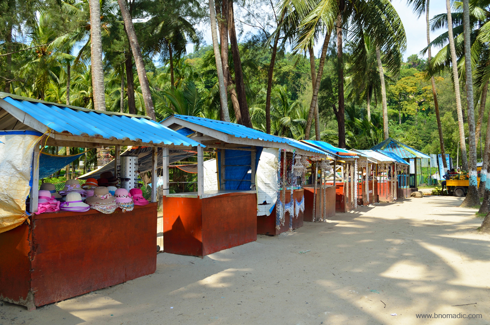
The shacks near the Radhanagar Beach. Please visit Flickr for more images of the region

The entry gate to the Radhanagar beachside. Please visit Flickr for more images of the region

The green pandanus, a staple food of the aborigines, at Havelock. More images at Flickr
I have budgeted three nights for Havelock. A balmy evening breeze greets us at the jetty. The blue waters and the lovely weather calm everyone down. In fact, one of the most elating aspects of my sojourn in the Andamans was its climate. Seemingly controlled by a natural thermostat that regulates heat as well as cold, the islands have the same climate throughout the year. Owing to its nearness to the equator, climate extremes are non-existent here; but it rains almost eight months in a year stretching the monsoon season on both ends. The rains are often torrential and incessant. Storm, thunder and lightning almost inevitably accompany the rains. Weeklong incessant rains, which are common here also provides a solution to the potable water shortage in these islands. As the islands are densely forested, on normal days, the dusk and dawn are pleasant here. At night, the cool sea breeze refreshes the soul.
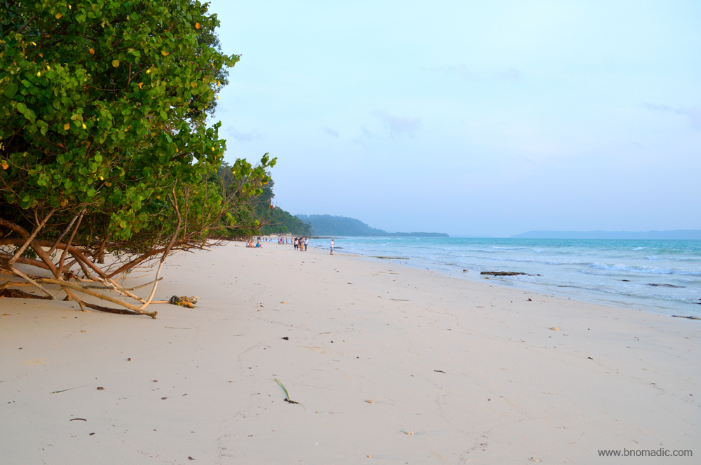
Like any other island in the Andamans, the Havelock is a captivating sight, even from several kilometres away from the sea: the rippling emerald green waves lapping gently against a sandy white beaches leading to hillocks and mounds that are rich with vegetation and tall trees covered in dense foliage; their sturdy trunks and thick barks supporting dozens of vines and other creepers. With a hundred different shades of green and blue, it seems as if someone had very artistically placed these beautiful islands in the middle of a sea. Standing tall, countless huge trees proudly hold their branches aloft leading to a serene green darkness. A row of cottages and offices are constructed on the seafront on the northeastern edge of the island close to the jetty. As shipping is the main mode of transportation to the island, the jetty remains the hub of all activities. The magnificent view of the sea in different hues of blue is spectacular from the complex.
A low-tide seascape on the northeastern edge of Havelock. More images from the region at Flickr

The Anju Coco Restaurant, Havelock Island. Please visit Flickr for more images of the region

The multi-cuisine restaurant is particularly famous for seafood and South Indian dishes
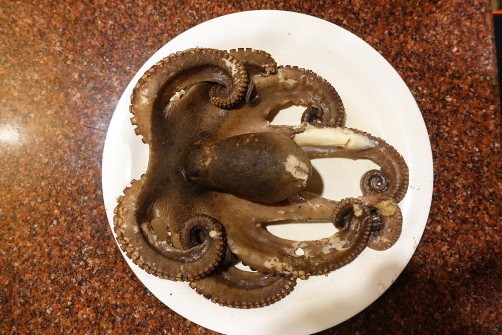
Definitely not my fodder; someone sitting at the next table orders a boiled Octopus
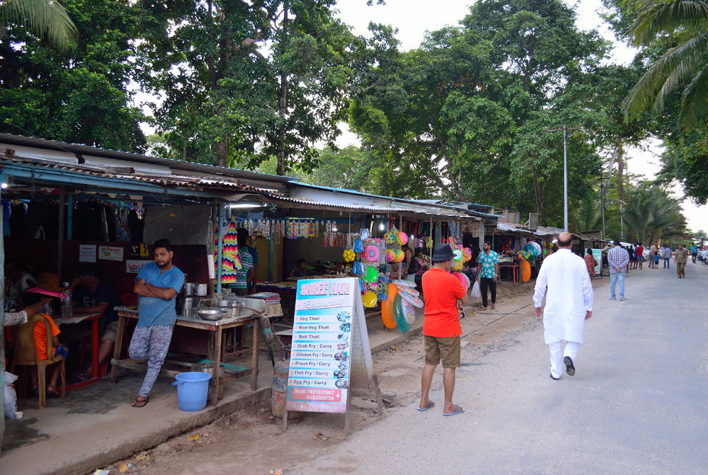
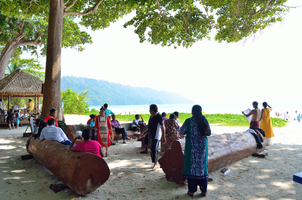
For the next few days, I devote mornings to Kalapathar area and the evenings to Radhanagar part. The numerous cafés and eating joints that dots the island, works best for afternoon siesta. My pick is the Anju Coco Café run by a sardarji from Paharganj in Delhi. Unlike other islands of the archipelago, the settlers of Havelock are the luckiest ones as the island receives the highest number of tourists after Port Blair. Still, there are many areas and beaches on this island which are completely unoccupied and serene; fit to enjoy seclusion. To assist, the administration has also assigned number markings to all the beaches. Quite intriguingly, whereas the beaches and villages of the island have Indian names, the name of the island itself is of British origin. The reason lies in its recent history.
The Andamans are fairly new for a civilised world and many areas are yet to be named. The British wiped out aborigines from the islands to establish a penal colony as well as to secure the Bay of Bengal for themselves. The sweat and blood of the convicts are behind every permanent feature in the penal settlement of Port Blair. Tortured by the British in most cruel way, they cleared the forests to build roads, construct houses and did their best to obey the oppressors. Their labours gradually transformed the dense forests of dreaded islands into a beautiful, pleasant habitation. Gradually, as settlements came up, they were named by the British after senior administrators who were associated with Andamans in any which way or after places in the home country; or even in memory of the British generals who had helped to quell the 1857 revolt: such as Havelock Island, Sir Hugh Rose Island, Sir John Lawrence Island, Sir Henry Lawrence Island, Neill Island, Port Campbell and Aberdeen Bazaar, etcetera.

The main highway through the Havelock Island; the island is 18km in length and 8km in breadth

Shacks by the Kalapathar Beach. Please visit Flickr for more images of the region

The Orange Coconut
The Green Coconut

Exotic fruits; I particularly liked the locally grown bananas and papayas. More images at Flickr
Initially the settlers comprised convicts but after India gained independence, refugees migrating to India were given land in and around Port Blair. When that was no longer available, they were given land in more distant places such as the Havelock Island, Middle or North Andaman. The Hindu Bengali families who migrated to India after the partition of Bengal were allotted land in the Havelock by the Government of India. The refugees named their initial settlement on the island as Govind Nagar. Subsequently all the other popular beaches and places were named by the initial settlers. Today, Havelock, the largest island of the Ritchie’s Archipelago lying east of the Great Andaman, is among the most culturally homogenous islands of the Andamans.

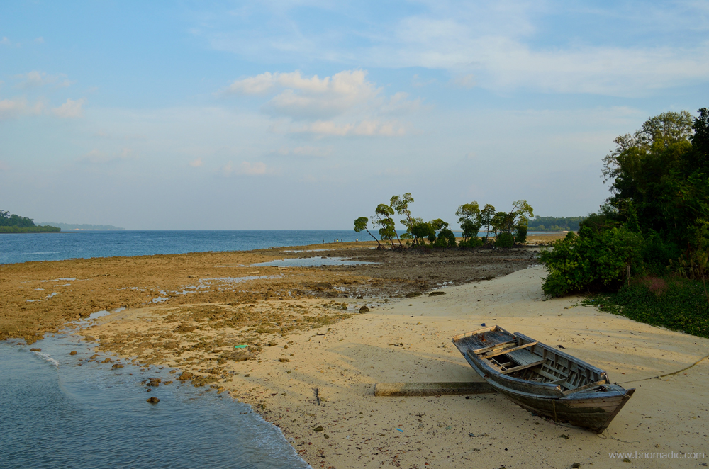
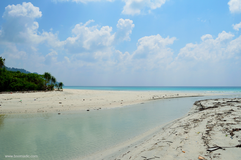
The Vijaynagar Beach during low tide and the exposed rocks and coral reefs. More at Flickr

The angry sea at Vijaynagar around midnight. Please visit Flickr for more images

The Vijaynagar Beach during high tide. Please visit Flickr for more images of the region

A live shelled mollusc at the beach. Please visit Flickr for more images of the region

These intricate galaxy-like patterns are produced by sand bubbler crabs as they burrow into the beach

The humble tiny artists use their claws to dig into the beach, sift through the sand and toss the balls behind them
With breathtakingly beautiful silken beaches, lush forested interiors and some of the best diving possibilities in South Asia, the Havelock is a perfect holiday destination to chill out on its sun-toasted beaches. Ever since the Time magazine rated the Radhanagar beach as one of the best beaches in Asia, the tourists flow has been registering an increase with every passing year. With a length of over two kilometres and an average width of 30 to 40 metres, the sandy white beach is indeed very beautiful and worth a visit. Fit for swimming, the beach continues out into the sea as a sandy bottom for nearly 100 metres. While the Kalapathar beach is famous for observing sunrise, the Radhanagar is at its best during a sunset. Most of the resorts are located along the Vijayanagar beach. Approachable either by trekking or through a boat, the Elephant beach is a good site for snorkelling. Both the Vijayanagar and Kalapathar beaches have a rich coral reef formation and an amazing underwater marine life.
Tall Mahua trees by the Radhanagar Beach provide a shady resting place in between swims

The Mahua has a large spreading superficial root system that holds soil together and prevents soil erosion

The unfortunate leftovers of “tourists”. Please visit Flickr for more images of the region

A tidal creek at Havelock. Please visit Flickr for more images of the region
The creek meeting the Andaman Sea. Please visit Flickr for more images of the region
The practical ways to roam around on the island are to rent a scooterette, hire a cab or be on your own. Every morning, I’d leave my room to reach the Kalapathar before the sunrise and come back only after soaking in the magical sundown at the Radhanagar beach. The islands of Andaman are surprisingly bereft of any predatory animal except for saltwater crocodiles. The only animals now found in the islands are wild boars, feral elephants, deer, cows, buffaloes, pigs, cats, goats and dogs. Except for the Great Nicobar, no other island has monkeys. The islands are of course abounded by snakes but not all of them are poisonous. The two creatures that the settlers dread the most after snakes are kankhajura and shark, which throng the seas surrounding the landmasses.

The Radhanagar Beach is the most famous one in the entire Andamans. More images at Flickr

The beach is rated as one of the best in Asia. Please visit Flickr for more images of the region

The calm waters of the Andaman Sea by the sublime silken Radhanagar Beach. More at Flickr
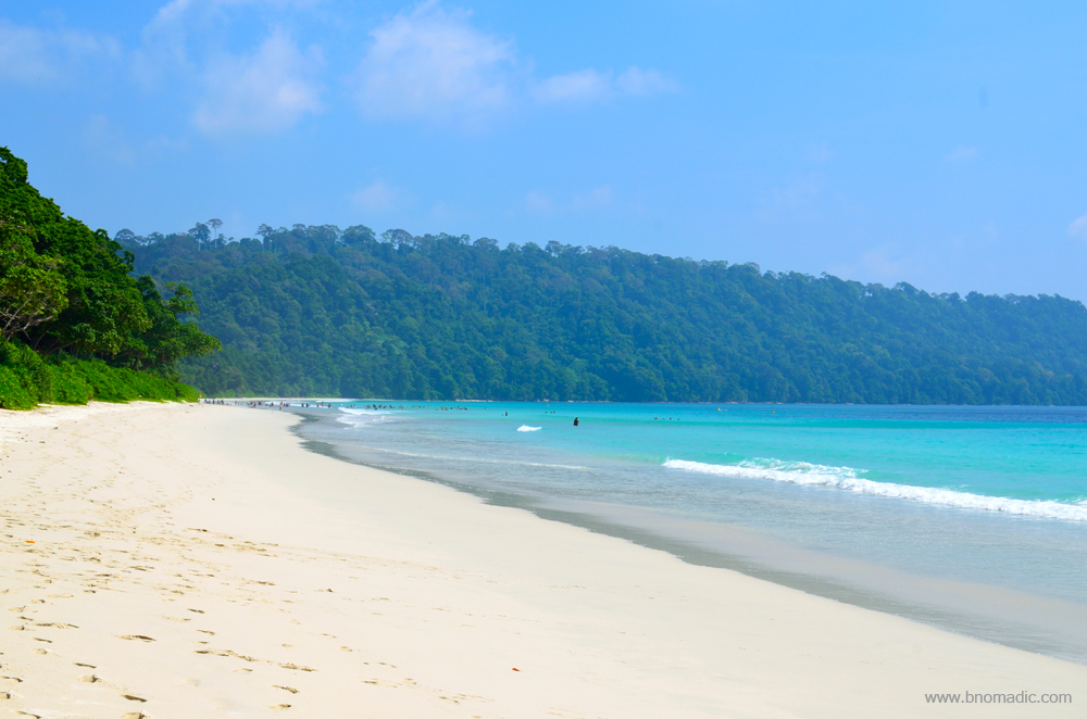
The crescent-shaped white sandy Radhanagar Beach is more than two km long. More images at Flickr
Sundown at the Radhanagar Beach; resets your mood to start afresh. More images at Flickr

How else would one wish to end his day? love and a sunset. More images from the region at Flickr
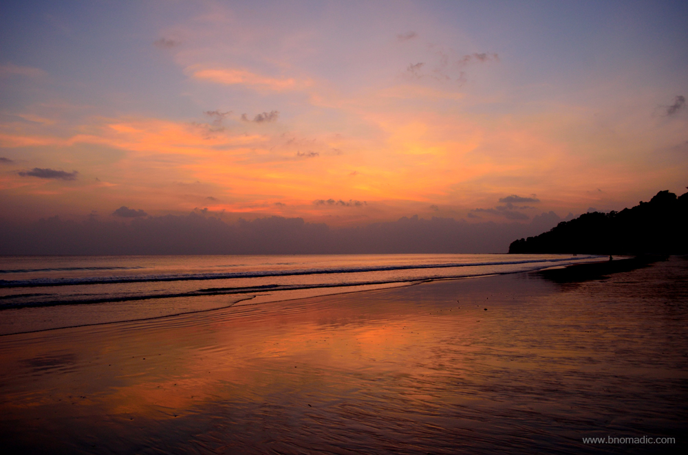
One of the umpteen moods of the Andaman Sea. Please visit Flickr for more images of the region
Even though, thronged by tourists in large numbers and little affected by the tsunami of 2004, the Havelock remains to be a natural treasure. Out of the total 572 beautiful islands that together form the Union Territory of Andaman and Nicobar Islands, 368 landmasses are, in fact, isles or rocks propping out of the water surface. Most of the islands of the Andamans are uninhabited, out of bound for tourists and are veiled in mystery. These islands are listed among the tropical, evergreen forests of the world. And true to its character, such a wealth of lushness, such a unique combination of aquamarine and emerald, such a dreamy place doesn’t exist elsewhere in India. Elsewhere seasons change, trees shed their leaves; but the islands remain clothed in green all through the year. It won’t be uncommon to notice old leaves on one branch, new leaves on the other; blossoms on one and fruit on another.
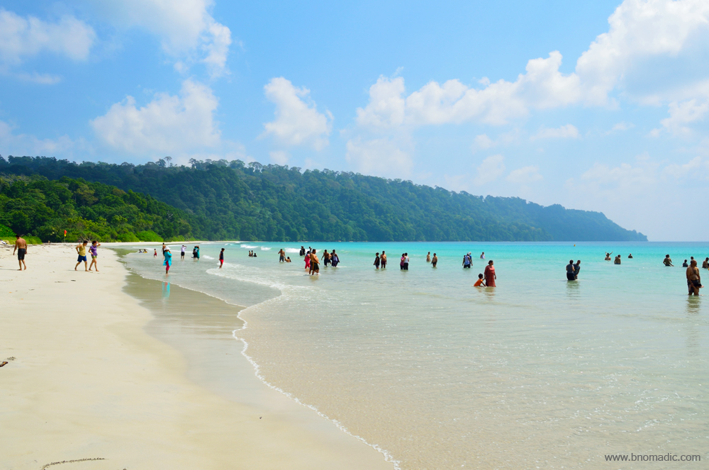
The Radhanagar is one of the best beaches for swimming. More from the region at Flickr

Candids from Havelock
Candids from Havelock; most tourists visit Havelock for a day from Port Blair. Radhanagar sees more crowd during noon and early evening.

Candids from Havelock

Candids from Havelock
As I begin to conclude my sojourn at the island, I must admit that the varied aspects of nature that I have seen here – the sandy beaches, the blue water, the hillocks, the glens, the jetties, the canoes and villages, all nestled in the bosom of a vast ocean, which is forever ready to consume the soil and greens of these islands; and observe its many moods – are beyond any comparison. Stretching south of Myanmar to the north of Indonesia, the island spans nearly 800 km from its northernmost tip to southernmost in a bow-shaped manner. Many geologists believe that a submerged mountain range stretches from Myanmar to Indonesia and the visible upper parts of the range form the Andaman and Nicobar Islands. Adding to the intrigue is its remote location: some 1400 km from the Indian mainland or just 150km from Indonesia and 190km from Myanmar.
Catching the morning rays at Kalapathar beach, Havelock Island. Please visit Flickr for more images

The lure of faraway islands. Please visit Flickr for more images of the region

Dawn by the Andaman Sea; a perfect oceanside getaway. As the corals around the island are in patches, soil erosion is common. Please visit Flickr for more images
Only the waters of Andamans and sky and a timeless vastness all around to give you a company

Pandanus groves by the Kalapathar beach. Big trees often succumb to high tide erosion. A number of trees can almost always be seen leaning on the sea and they finally succumb to it. Please visit Flickr for more images

The morning moods of the Kalapathar beach. Please visit Flickr for more images of the region
The return voyage to Port Blair, nearly 50 km on sea route is, however, smooth as a breeze. Chopping the white waves, our vessel is making a steady progress on the surface of dark blue water. There aren’t any birds; only the vastness of the sea. The texture and curls of waves presents myriad patterns. The sun unobtrusively glitters on the water surface making it appear like molten metal instead. With the calmness around, just like the passengers, the catamaran crew heaves a sigh of relief as we are midway our hour-and-a-half-long journey. Michael, a young sailor who hails from Chowra tells me that he always aimed to be a captain of a ship and is still struggling to be one. He doesn’t want to discuss about the tsunami of 2004 but tells me that settlers and natives of Andamans still shudder in fear while talking of the natural disaster that affected almost every living creature in the islands. Apart from the tsunami of 2004 that consumed over 7,000 recorded lives in the islands, the period that Andamans would definitely want to forget are the century-long hold of the British as well as the three years of the Japanese occupation – a virtual reign of terror – that had wiped out almost 45 per cent of the then population of the islands.

The crowd awaiting the arrival of ferry at the Havelock Jetty. More images from the region at Flickr
The Havelock Jetty and the calm waters of the Andaman Sea; the landmass in front is Sir William Peel Island

The Havelock Jetty; the small concrete protrusion in the waters is to warn the ships of the fragile coral reefs
The empty snacks counter inside the ferry. Please visit Flickr for more images of the region

Sailing back to Port Blair. Please visit Flickr for more images of the region

Say Hello to Dolphins! Please visit Flickr for more images of the region
Getting There
The most practical way of reaching the beach paradise of the Havelock Island is through the sea route. Weather permitting; ferries take about 1.5 to 3 hours in reaching Havelock Jetty through the Phoenix Bay Jetty of Port Blair. The catamaran operated by privately managed Makruz is the quickest as well as most comfortable option to reach the island from Port Blair. The DSS managed government ferries take about 2.5 to 3 hours in covering the same distance. The ferry schedule takes a hit every year during monsoons.
Otherwise, you need to be really lucky to manage a seat in the privately managed helicopter services. The sea plane service too has nearly been a nonstarter on this route. Whichever option you may prefer, always book well in advance and remain aware that the timings too are often changed without prior announcement.
Best time to visit: Any time of the year except monsoons
Travel Lure: Beaches and Marine life
Accommodation: Available but always confirm in advance
Andamans Diary: The island town of Port Blair

When I began planning this trip about a month ago, I was intrigued at the thought of how distant and isolated the island group of Andaman and Nicobar actually was. The Andamans are even farther than what I used to mark on a physical map of India during my school exams. The nearest Indian mainland port is around 1300 km from Port Blair, the capital township of the islands. Beautiful beaches, magnificent sea creatures, lush forests, strange tribes, a penal housing, kalapani and the devastating tsunami of 2004 basically sums up what I knew of these islands till recently. An involved research brought some more interesting facts about these islands.
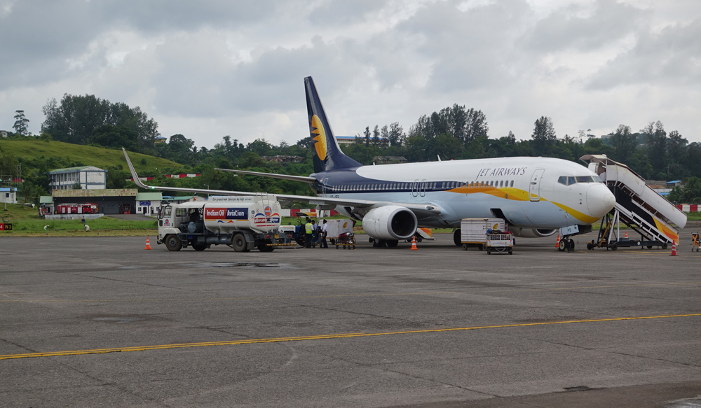
Finally at the Veer Savarkar International Airport of Port Blair. More images at Flickr
Aboard a Jet Airways flight, I spread a map-cum-fact sheet of the Andamans as I patiently wait for the aircraft to take-off in Chennai. The airport operations are temporarily put on hold to facilitate a VVIP movement. Of the total of 572 islands in the Union Territory of Andaman and Nicobar Islands, only about 38 are permanently inhabited, the unverified document says. Separated by a 150km wide turbulent Ten Degree Channel, the Andaman group has 325 islands, whereas, the Nicobar group has 247 islands. The closest foreign land mass is Coco, a Burmese group of islands that lie approximately 20 km away from the northernmost tip of the Andamans. The next couple of hours or so on the flight to Port Blair, the gateway to the islands, are spent in planning and identifying day walks for the next one week.

Port Blair is situated on the southern end of the main landmass of the Great Andaman Island. As the aircraft begins to descend and land on the Veer Savarkar International Airport of Port Blair, I am awestruck to see the seascapes from above. I hadn’t seen anything like that before. Outlined by sugar-white beaches, the lush forests or mangroves of the islands are surrounded by shimmering turquoise waters of the Bay of Bengal. The sky is clear. Our plane must have been flying over the islands of the Mahatma Gandhi Marine National Park, I assume. The spectacular view of the deep blue sea instantly vanished as a submerged patch appeared. The next moment our aircraft is taxing on the Port Blair airstrip, the foundation of which was laid by the Japanese during the World War-II, and is now jointly managed and used by the Airports Authority of India as well as the Indian Navy.
Finding an accommodation could be a tricky exercise in a tourist season on these islands. Accommodation is plentiful but so is the tourist rush. Apart from construction material and furnishings, most properties have to source raw materials for food and provisions, etcetera from the mainland, hence, the rents and charges are mostly inflated, especially in the on-season. Not that the low budget options aren’t available in the town but it is advisable to book a few months in advance. Given the flight and inter-island ferry timings, most properties have an 8 AM checkout policy. The early checkout timings might cause a little annoyance but the good thing is that the sunrise timings in these islands precede the sunup in the Indian mainland by an hour and a half approximately. Another concern while identifying an accommodation could be transportation. Even though, cabs, autos and buses are readily available but fixing one might involve a little bargain. Thankfully, my accommodation is pre-booked and so is the transportation.

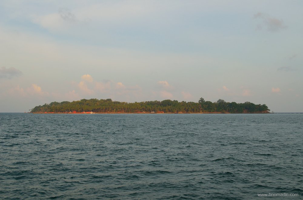
Room with a view; the island in front is what is printed on a Rs 20 currency note. More at Flickr
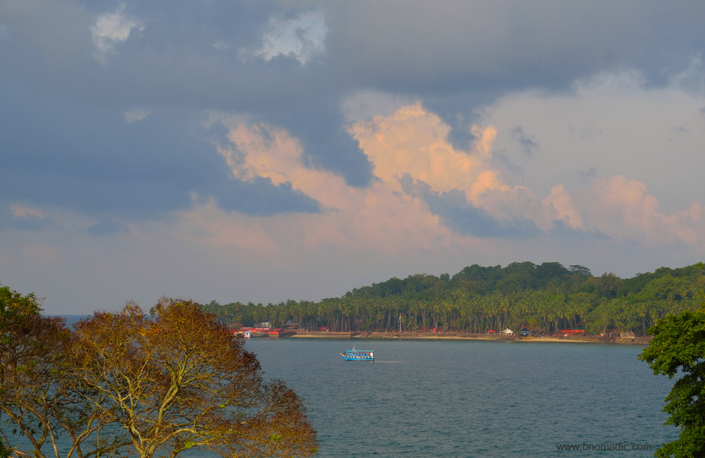
A boat ferrying between the Ross Island and Port Blair; a tourist boat had capsized in these waters in 2014
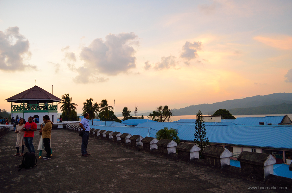
Overlooking the blue sea, my accommodation is positioned atop a hillock. The chief promenade of the town, the marine drive that seems to encroach upon the territory of the sea is in full view along with the Aberdeen jetty. Far towards the left, I could spot the remaining three distinct spokes of the Cellular Jail. Right in front in the middle of the sea is a tiny island known as Ross that is gazing out to sea like a sentinel. I gaze at the exquisiteness of the seascape – the forested islands and the shining hues of the Andaman seas, which, for many centuries, have remained a mysterious as well as dreadful region to the rest of the world. Even till few decades before, the sailors passing through the Bay of Bengal held the belief that natives of these beautiful islands were cannibals. And because of this infamy, Andamans continued to be feared. Merchant ships from across the globe passed through the international trade routes which lay close to the islands. Many a time, due to natural calamities or urgencies, some of such ships made desperate attempts to anchor at the islands. On most such unfortunate occasions, the sailors received sudden but savage response from the aborigines. Not many would come back alive. As far as possible, ships tried to avoid passing close through the islands. If a visitor somehow managed to remain hidden from the sight and sharp arrows of the aborigines; the calamitous weather, shortage of food and the life-threatening malaria would make the survival a chanced affair.

The Raj Niwas, the residence of Lieutenant Governor, Port Blair. More images at Flickr

Sea view from the garden of the Raj Niwas. Please visit Flickr for more images of the region
When the British began to establish a penal settlement at an island, Chatham inside the Port Blair harbour, the aborigines fiercely resisted all acts to do so. After the initial survey of the islands in 1777 by John Ritchie, the East Indian Company appointed Captain Archibald Blair, a hydrographer and Colonel Colebrook, the Surveyor General to survey the entire archipelago and its surroundings in 1789. In their findings, they wrote that the islanders are probably among the most primitive human beings in the whole world. With much difficulty and superhuman efforts, Captain Blair managed to drive away the natives, clear some forests and build some houses and penal structures in the same year with the help of a few Bengali labourers and skilled workers which he brought from the mainland for the purpose. Gradually, the East Indian Company began to gain a foothold in these islands; nonetheless, a location of strategic importance in the busy Bay of Bengal. Before commencing the construction of the infamous Cellular Jail in 1879, the British had to twice shift the penal colonies from South Andaman to North and then back. Underestimation of the catastrophic climate, savagery of the aborigines and malaria kept them occupied. Subsequently smaller penal structures were added in the vicinity of Port Blair, such as in the Viper Island.
For the next four days, I keep myself engaged in understanding and exploring the streets and corners of the island town of Port Blair. On all days, almost unavoidable to visit was the centrally located Aberdeen market, the main and the town’s most crowded portion. Port Blair was a new land; and the British tapped the opportunity and named the landmarks or islands as per their whims and fancies. This area, Aberdeen was the site of the largest armed conflict – between the British and the Andaman aborigines in 1859 – which later came to be known as the Battle of Aberdeen and marked the beginning of Struggle for Freedom by the natives. The homesick British subsequently named this area after Aberdeen of Scotland. Adjacent to the Aberdeen Market, there is a settlement by the same name. The settlement of the town later developed around it.
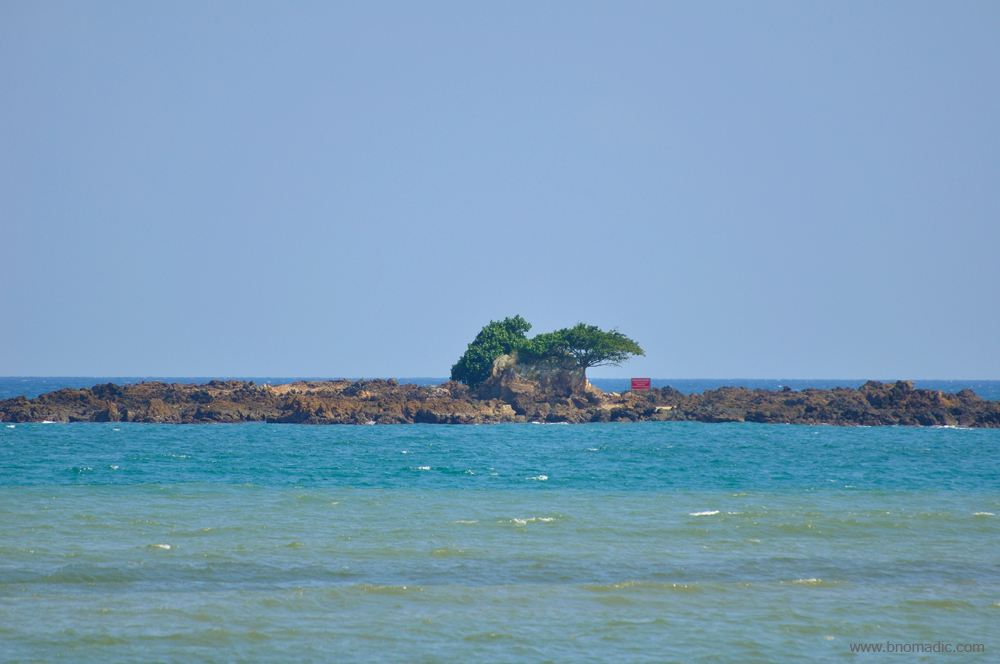
A closeup of the Snake Island as observed from Port Blair. More images from the region at Flickr
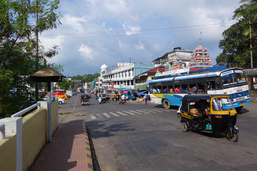
The Aberdeen Market; the Police Gurudwara is also in the frame. More images at Flickr

The Annapurna Cafe is among the popular food joints especially for South Indian cuisine. More at Flickr
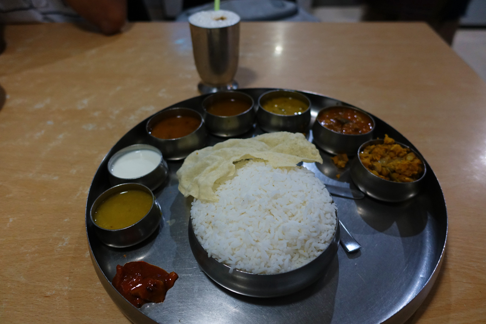
My South Indian Thali at the Annapurna; the butter milk. More images from the region at Flickr

The Fisheries Museum, Port Blair exhibits specimens from underwater life. More at Flickr
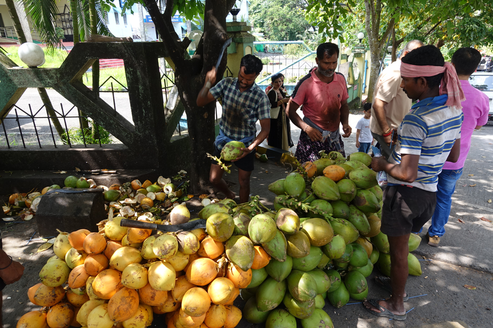
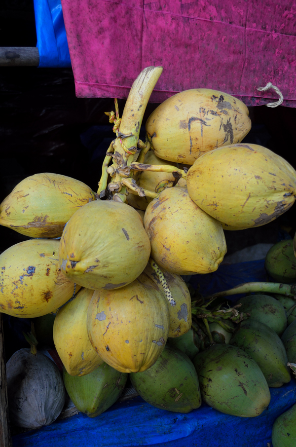
Relished both the varieties of Coconuts, grown here through plantation farming. More at Flickr
The Anthropological Museum exhibits portraits and artifacts of the aborigines. More at Flickr

Inside the Anthropological Museum. Please visit Flickr for more images of the region

Hunting tools used by the aborigines. More images from the region at Flickr

Some more tools. Please visit Flickr for more images of the region

The souvenir shop at the Anthropological Museum. Please visit Flickr for more images
Superficially, the town may not look any different from most small towns of the Indian mainland. But of course, the landscape is an exquisite combination of hills and seas; with all shades of greens and blues. Soon I realised that here everything is based on marine economy; and water, its perils and pleasures surrounds just about everything. Villages and tehsils are separated not by roads but sea; boats or ships are the popular mode of transport; vehicles assemble at jetties where reservation counters booked a ship ticket; seafood is the popular street food; museums showcased marine shells and trophies; bays, coves and beaches presented promenades; travel plans are dictated by the timing of high tide or low tide; shape of the moon is a factor in dictating transport safety; checking precise tidal information from newspapers is an essential part of daily chores.
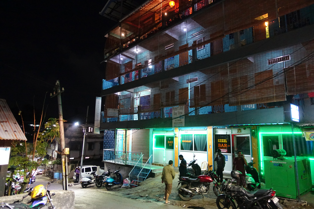
The Lalaji Bay View Guest House is a budget alternative for backpackers. More images at Flickr

The Excel Restaurant atop the Lalaji Bay View Guest House. More images from the region at Flickr
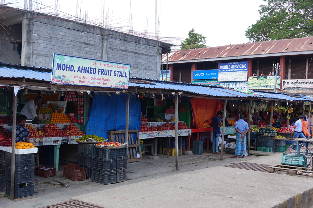
The Fruit market, Port Blair; most of the fruits are sourced from the Indian mainland. More at Flickr

The Samudrika Naval Marine Museum that showcases marine life including some shells. More at Flickr

Artillery Gun used by the Indian Navy at display. Please visit Flickr for more images of the region

A flat screen that shows travel documentaries about Andamans; people watch it mostly to take a rest
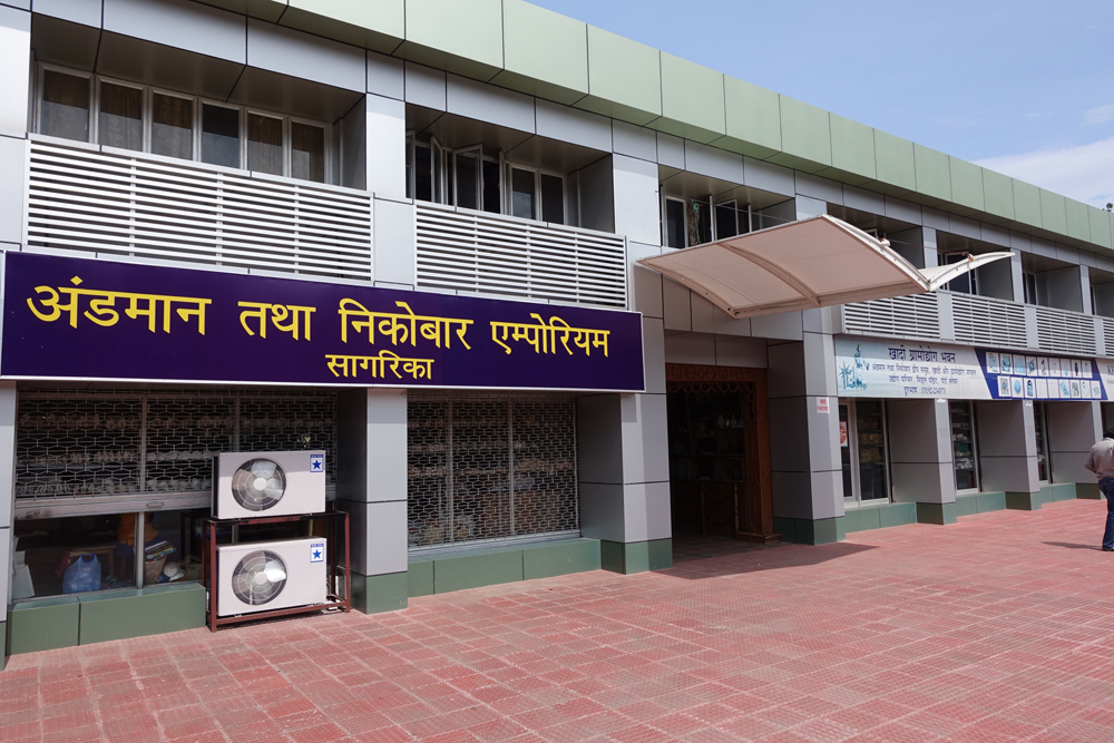
The Sagarika store at Port Blair. Please visit Flickr for more images of the region

Inside Sagarika

Inside Sagarika
Most of the popular places of interest in the town like Fisheries Museum, Cellular Jail, Corbyn’s Cove, Mini Zoo, Japanese Bunkers, Anthropological Museum, Chatham Saw Mill, Samudrika Naval Museum, and etcetera are located within an easy access from the Aberdeen Market. I visit all these landmarks one by one. There are many attractive picnic spots in the vicinity of the town. A popular one is Corbyn’s Cove, a safer beach for bathing and seaside activities, where the sea has neither underwater rocks nor predatory fishes. A government-raised coconut plantation fringes the beach. Every year monsoons make this cove tempestuous when waves unceasingly crash on to the land and every year a little bit of Corbyn’s Cove along with a swathe of coconut palms is swallowed up by the ocean. The administration has built a concrete sea wall to check this erosion. The beach is named after Reverend Corbyn by the British. A padre of Port Blair, Corbyn was employed by the British to befriend the natives and win their trust after the natives did not stop attacking the settlements. For the purpose, Corbyn had set up the Andaman Home, a cluster of huts at the Ross Island, where Corbyn tried offering them material blandishments.

The sea is relatively calm here except in the monsoons. Please visit Flickr for more images

Corbyn’s Cove is located close to Port Blair. Please visit Flickr for more images of the region

A Japanese Army bunker at the Corbyn’s Cove, Port Blair. Please visit Flickr for more images
The beach is lined with many shacks. Please visit Flickr for more images
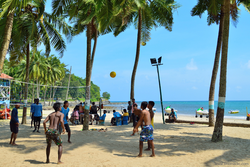
Tour operators and life guards playing beach volley. Please visit Flickr for more images
The beach is considered safe for bathing and swimming. Please visit Flickr for more images

Coconut plantation by the Corbyn’s Cove beach
A mobile cam image of a typical sunset from Chidiya Tapu; the stinger net enclosure provides protection against crocodiles and predatory marine life
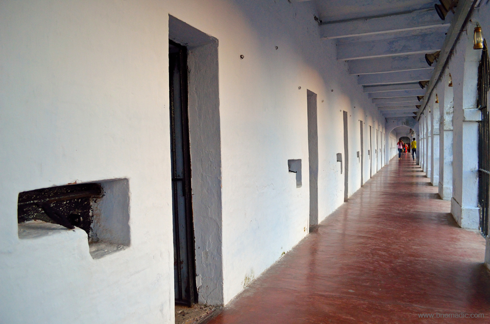
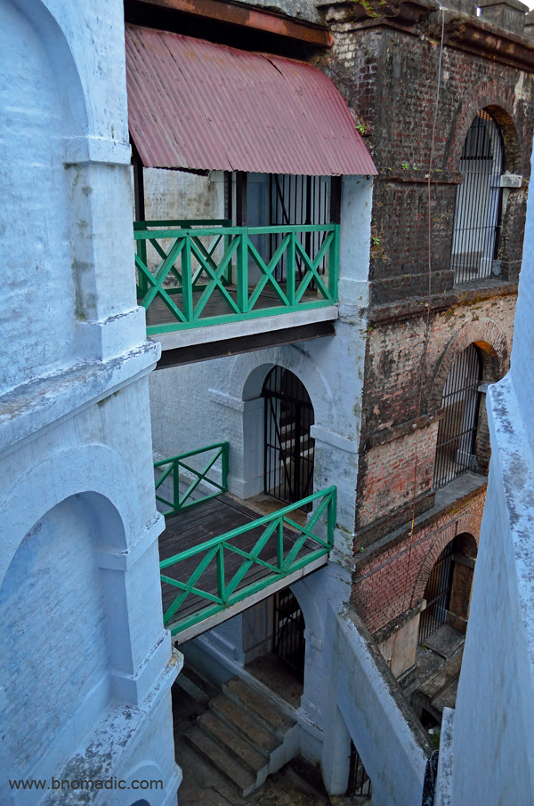
I devote two evenings to visit the most popular landmarks of the Andamans – the Cellular Jail and the Ross Island. The Light and Sound show makes the evenings here particularly noteworthy. Before entering the Cellular Jail premises, I stand in front of the main entrance on the road and pay my obeisance to the freedom fighters. The entry to the jail complex is through a gate placed in the middle of a large two-storeyed wooden building. Two rooms on either side, which served as the jail office when the jail was in use and later converted into hospital, now housed jail memorabilia. I wander around the imposing structures, from one wing to another, once again awestruck at the fortress-like construction that looked practically impregnable. Overwhelmed with a mixture of wonder and sorrow, I muse over the past of this complex. I am staring at the walls of the complex that had been home to so many tortured and tormented people. Even the very name of the Cellular Jail would instigate terror in the mind of the most hardened criminals. It is not hard to reconstruct the terrible activities that happened behind the prison walls of the Cellular Jail, the Bastille of India.
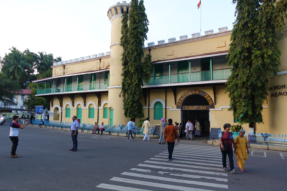
The Cellular Jail is among the most popular landmarks of the Andaman & Nicobar Islands. More at Flickr
Replicating the Pentonville Prison of Britain, the Cellular Jail was constructed in such a manner that a lone sentry could guard all the cells by remaining around the watch tower. Escape was nearly impossible. With the bricks and other material for construction brought on ships from Burma, convicts were made to work as slaves. At one corner of the complex are the old gallows that could support three nooses. The original sample oil press is still put on display inside the compound. A convict would push the rod, moving in circles around the bowl to squeeze out at least 15 seers of mustard oil a day. Near the oil press is a man-sized iron flogging frame to which stripped convicts were fastened and flogged till they started bleeding. I feel transported to our tragic past when the convicts were treated in an absolute brutal way. A thorough disregard to rules, regulations and fair play was observed. Frequent spread of disease, unhygienic food and torturous living arrangements were the norm. The inhumanity of the British was unimaginable. The convicts desperately looked for opportunities to escape from the hell-like settlement.

The accessible wing of the compound stands a mute witness to the tortures meted out to the convicts

Bearing a testimony to the tortures of the olden times, the workshop has old memorabilia.

A sample Oil Press. Please visit Flickr for more images of the region
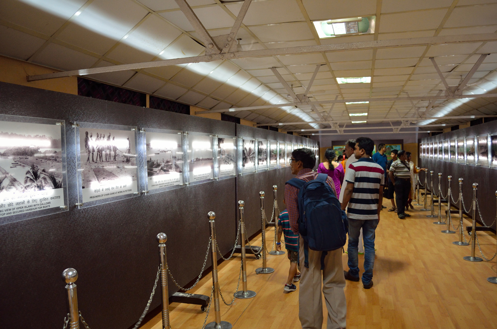
The exhibition hall showcases old photographs of the convicts, their activities and the jail. More at Flickr

The gallows, built next to the mess, could support up to three nooses. More images at Flickr
The structure below to collect corpses
Today, the National Monument has also almost become a pilgrimage center. More images at Flickr

Curious visitors probing the unique door lock system; the glorified Savarkar cell in front

Inside the Savarkar Cell. More at Flickr
A sentry could observe all seven wings from the watchtower
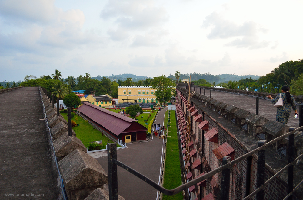
View from the terrace of the wings. Please visit Flickr for more images of the region

The view of the sea and the Ross Island from the terrace of the Jail. More images at Flickr
View towards the North Bay from the terrace. Please visit Flickr for more images of the region
Of the seven wings of the original Cellular Jail, only three remained intact. Rest all were demolished at different point in time for clearing the area. The bricks were later reused including for making a hospital at the same site. Today only a solitary wing is open for visitors and stand as a mute reminder of the despicable acts of the British. I wander around the complex prudently observing the cells. The small cells were ventilated by a tiny skylight built closer to the ceiling. The uniquely designed huge locks are still intact. The entire arrangement was so cleverly designed that it was next to impossible for a convict to reach the lock from inside the cell to set him free. The last cell of the top floor was assigned to Veer Savarkar, the most politically celebrated convict of the jail who was assigned 50 years of solitary life confinement. He was arrested in 1910 but somehow managed to be released by 1921. To me, the convicts of the Gadar Party, who came to the jail in 1915, deserved a special accolade. These tall, muscular, heavily built prisoners, who were mostly Sikhs, started to instead create trouble for the authorities. The Gadar prisoners resorted to protest after protest, strike after strike, testing the very limit of the tolerance of the jail authorities. Sensing the trouble, the British sent them back to the Indian mainland by 1921 after which jail conditions improved drastically for the convicts but only for a short while.
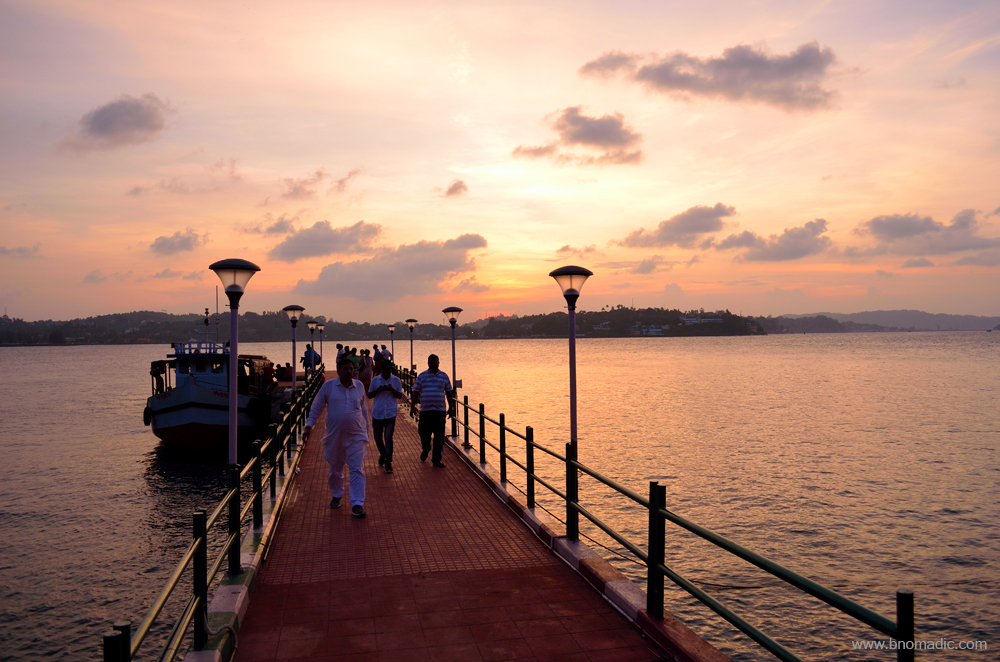
Perhaps afraid of the threat posed by the aborigines as well as the revengeful convicts, most top officials, along with their families, of the British preferred to stay at the small Ross Island. I board a boat for the Ross from the Aberdeen Jetty. It takes less than 10 minutes in reaching the Ross Jetty. After the Indian Navy set up a base in the Andamans as an aftereffect of the Sino-Indian war of 1962, INS Jarawa was commissioned to oversee all naval operations on the islands. With no permanent habitation at the island, the Ross now comes under the purview of the INS Jarawa. The red-painted remnants of a flourishing past along with the natural beauty of this small island overwhelm me. A well-kept Japanese army bunker that was obviously a later addition as the British were preparing to leave the island is positioned at the jetty.
The Ross Island as observed from Port Blair. Please visit Flickr for more images of the region
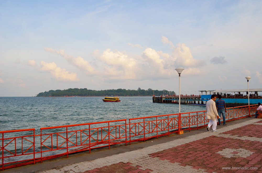
The Aberdeen Jetty; the Ross Island in the backdrop. Please visit Flickr for more images
The Ross Jetty; Port Blair in the backdrop. Please visit Flickr for more images of the region

A bunker constructed by the Japanese Army during the World War II. More images at Flickr

The ruins of Ross Island; frankly I was not expecting anything like these memoirs of the past on the Ross; the deer were brought to the Andamans by the British in 1920s. More images from the region at Flickr

With most modern amenities of a civilised town, what Ross must have been when it was the garrison headquarters of the Andamans. Please visit Flickr for more images of the region
The island is now a part of the INS Jarawa, maintained by the Indian Navy. More at Flickr

Palms, dappled shadows and weathered ruins greets a visitor to the islands. More at Flickr
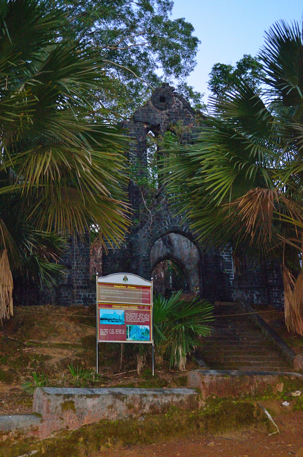
Ruins of the Anglican Church at the Ross

The expanse of sea between the Ross Island and Port Blair. Please visit Flickr for more images of the region
The British are the masters in making life comfortable for them. The ruins of luxuriant houses, clubs, a swimming pool, shopping arcade, bakeries, tennis court, ball room, paved streets, testifies the quantum of how smooth and luxurious life must have been for the British at the Ross during those times. Boats were the only means of transport then, even as hundreds of convicts were used the British to clean and maintain the surroundings. A major earthquake in past caused several structures at the Ross to perish after which a few geologists pronounced it to be a sinking island. The Ross was abandoned in 1941. Later the Japanese whenever needed to construct a new building they merely broke down some of the existing buildings at the Ross and used the bricks and beams. Today it has become a picnic spot for the visitors. True to its character as a natural outpost, on the opposite side of the Ross, the sea stretches uninterrupted for miles and miles around. Militarily speaking, the Ross is an ideal place to watch the movements in the Bay of Bengal and see the approaching ships.

The Light and Sound show at the Cellular Jail. Please visit Flickr for more images of the region

The Light and Sound show at the Ross Island. Both shows give all the necessary information to further intrigue your mind. Please visit Flickr for more images of the region

Tsunami Memorial to commemorate the lives lost in the Andamans in 2004 tsunami. More at Flickr

A memorial constructed in honour of the tribesmen who died in the Battle of Aberdeen
One thing is pretty much evident from the recent history of Port Blair that the birth of the civilisation in these islands has had a much bittered journey. The light and sound program at both locations basically sums it all. Overall, I wouldn’t have ever imagined that in such far waters, such a beautiful and intriguing region existed.
Getting There
Plainly speaking the island capital town of Port Blair may not be any different from other small towns of Indian mainland except for the blue and clean seaside. The laid back capital of the Union Territory of Andaman and Nicobar Islands is nearly 1300 km from Indian mainland. The route is connected with the mainland through sea as well as air. Depending upon the sea weather, a ship may take anywhere between two to four or even five days in reaching Port Blair from the East Coastline of India. Most domestic airlines operate flights to Port Blair from the main Indian cities. A flight from Chennai usually takes a little above couple of hours in reaching Port Blair. In terms of expenses and time, flight option proves to be more economical than a ship. Foreigners will require a Restricted Area Permit – which can be issued at the origin port if travelling by ship or upon arrival at the Port Blair International Airport, if flying in – to visit the islands.
Best time to visit: Any time of the year except monsoons
Travel Lure: Beaches, Heritage, Wildlife and Marine life
Accommodation: Plentiful but always confirm in advance
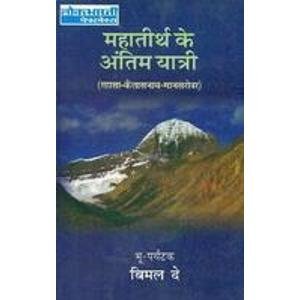
Book Talk: The Last Time I Saw Tibet; Mahatirtha Ke Antim Yatri

A first for me on bNomadic, this time through this post I’ll share my views on two books – The Last Time I Saw Tibet and Mahatirtha Ke Antim Yatri – which are, in fact, translation of the same book in English and Hindi languages. Recuperating from a surgery, this week I got an opportunity to lay my hands on both the versions of the book which was originally written in Bangla language by the courageous wanderer Bimal Dey.
The book presents an engaging narration of the author’s adventurous journey through the highlands of Tibet at a time when the Dalai Lama still called the shots from Lhasa in the trans-Himalayan terrain. Still a teenager then, unprepared Bimal ran from his house to join a group of Lamas and trek across the harsh terrain of Tibet to visit the sacred monasteries as well as the Kailash Mansarovar. The book was first published in 1982 as Mahatirther Shesh Jatri in Bangla. Translated by Dileep Kumar Banerjee, the Hindi edition was published in 1994 as Mahatirtha Ke Antim Yatri. Penned by Malobika Chaudhuri, the English language translation was published in 2007 as The Last Time I Saw Tibet.

Through the book, Bimal Dey recounts the travels and experiences of his group expedition to Lhasa, which later became a solo adventure across Tibet, in the spring of 1956. The travel chronicles of Dey will occupy a special place in the bookshelf of a Tibet lover as it brings out the life and times of the trans-Himalayan terrain when the Fourteenth Dalai Lama was still a child and ruled Tibet. His was possibly the last recorded attempt through Tibet before the Indians were banned from travelling there without obtaining a special permission from Beijing. During those times, Sikkim was yet to be recognised as a part of India and Chinese occupation of the Tibetan territory was still marked.
By 1956, the access to Tibet was nearly closed for foreigners, particularly Indians; somehow that year Dey managed to join a group of lamas from Nepal that had managed to secure permission from the Chinese Embassy in Kathmandu for a pilgrimage to the monasteries of Tibet. Having no knowledge of religious scriptures or Tibetan and Nepali language, Dey sets off as a mauni baba, a lama who had taken a vow of silence, for the fear of getting caught by the Chinese. He receives full moral support of his Guru, the leader of the group. The group trekked across the Nathu La, through the Chumbi Valley and by the Tsangpo to reach Lhasa visiting the historical monasteries and forts on the way. What the group dreaded the most was having to deal with Chinese Army personals who were deployed just about everywhere on the way till Lhasa.
During this part of the expedition, the group visited the town of Yatung, Dungkar monastery, Phari fort and monastery, Gyantse, Kiangphu Monastery, Samding Monastery, Chaksam Monastery, Drepung Monastery as well as the Jorkhang Temple, the Norbulingka, the Potala Palace where he even had an audience with His Holiness before leaving for the holy Kailash Mansarovar region. One of the best aspects of the travelogue is the meticulous account of raw and rugged Tibetan life as well as observations and learnings from the monasteries he visited in Tibet. He separates from the group at Lhasa to continue on his own to the Kailash and Mansarovar region, the holiest pilgrimage for Hindus, Buddhists, Jains and Bonpas. All through his journey, he made friends with locals, ascetics as well as mendicants. The awe-inspiring majesty of the Himalayas is reflected throughout his expression.
Clambering over rocks and steep hills for several days in the dreary and cold terrains of Tibet, the author narrates the difficulties he had to surmount in travelling through the country. The last chapter on Lhasa includes the changes he observed in the town and Tibet after the Chinese occupation of the country. He notes the gradual decimation of the Tibetan culture including its rich and unique traditions across the countryside. Bitten by wanderlust at quite a young age, Bimal Dey undertook a mega adventurous journey of over two lakh kilometre on an ordinary bicycle from 1967 to 1972, as also the expeditions to the Arctic and Antarctica. Still it’s his journey across Tibet, from Gangtok to Lhasa and Mansarovar, which holds a special place in his heart.
I rate this book an absolutely must buy for a trans-Himalayan travels enthusiast or who feels even slightly fascinated by the terrain and culture of Tibet. Dey’s sheer neglect to material things and comforts as he undertook this arduous journey across Tibet keeps the reader in a state of awe and admiration. Comparing the two translations, I find the Hindi version more gripping and presentable. Even though, I rarely trust or subscribe to translations, the narrative flavour of the Hindi edition seems more authentic. Just hoping not much expression is lost between the translations. The English translation of the book – The Last Time I Saw Tibet – continues to be out of print on Amazon and the Hindi version – Mahatirtha Ke Antim Yatri – is available for Rs 150 on the same website.


